The Mystery of the Nazca Lines: Why Were They Made?
Across the Peruvian desert, enormous animal figures, geometric shapes, and straight lines cover the landscape. Explore who created the Nazca Lines, how they were made, and what archaeologists think they were for.
The Mystery of the Nazca Lines: Why Were They Made?
Imagine standing in the middle of a desert and looking across a landscape that seems completely ordinary.
Brown earth.
Rocks.
Dust.
Almost no vegetation.
Nothing that immediately suggests a monumental work of art.
Then someone takes you into the air.
Suddenly, the landscape changes.
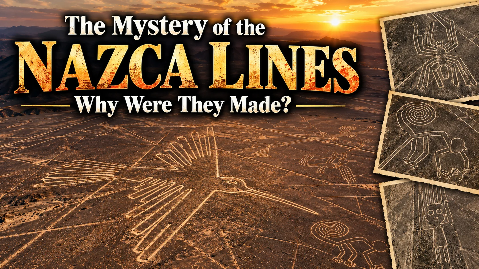
A giant hummingbird appears beneath you.
A monkey stretches across the desert.
A spider emerges from the earth.
Huge geometric shapes spread across the plain.
Straight lines extend for kilometers.
Some form enormous trapezoids.
Others intersect.
Some radiate from particular points.
And all of it was created without modern surveying equipment, aircraft, satellite imagery, or GPS.
The Nazca Lines are among the most famous archaeological landscapes on Earth.
They are also among the most misunderstood.
For decades, popular culture has asked:
Why would ancient people create drawings so large that they could supposedly only be understood from the sky?
That question led to:
Aliens.
Ancient astronauts.
Runways for spacecraft.
Messages to extraterrestrials.
Lost technologies.
Celestial maps.
Even gigantic calendars.
The real archaeological story is considerably more complicated.
And more interesting.
The people who created the geoglyphs were not trying to impress modern aircraft passengers.
They were building a landscape for people on the ground.
The lines were part of a ritual and social environment that could be experienced by walking through it.
Recent research has made that picture even more interesting. In 2024, an AI-assisted survey identified 303 previously unknown figurative geoglyphs, nearly doubling the known number of relief-type figurative geoglyphs. The study also found important differences between large line-type figures and smaller relief-type figures, suggesting that they may have served different purposes. DOI
So the mystery has changed.
It is no longer simply:
"How did they make giant pictures?"
We can answer that.
The harder question is:
"Why did they transform an enormous desert landscape into a network of paths, figures, symbols, and ceremonial spaces?"
What Exactly Are the Nazca Lines?
The term "Nazca Lines" refers to a huge collection of geoglyphs created on the desert surface of southern Peru.
The wider UNESCO World Heritage property covers roughly 450 square kilometers, with the protected archaeological area extending across more than 75,000 hectares. UNESCO World Heritage Centre
The geoglyphs include:
Animals.
Plants.
Human or humanoid figures.
Geometric shapes.
Long straight lines.
Trapezoids.
Spirals.
Wavy lines.
Large networked paths.
They weren't all made at the same time.
The tradition developed over many centuries.
They Are Older Than the Nazca Civilization Alone
This is one of the most interesting discoveries in recent decades.
For a long time, people naturally assumed:
Nazca Lines = Nazca people.
That's broadly useful but incomplete.
Some geoglyph traditions in the region predate the classic Nazca period.
UNESCO places the broader development of the geoglyph landscape between roughly the eighth century BC and eighth century AD, with important phases extending from the Formative period into the Nazca era and beyond. UNESCO World Heritage Centre
Other research has identified geoglyph traditions extending from earlier Formative periods into later pre-Inca times in the wider Andean region. Cambridge University Press
So this wasn't one civilization suddenly deciding:
"Let's draw a giant hummingbird."
It was a long-lived cultural tradition.
🟢 Established Evidence
The Nazca landscape contains geoglyphs produced by ancient Andean societies over a very long period.
The famous figures are part of a broader tradition of modifying the desert surface.
The tradition outlasted individual communities and changed over time. UNESCO World Heritage Centre
How Do You Make a Nazca Geoglyph?
The remarkable answer is:
You don't need exotic technology.
The desert provided the material.
Its surface is covered with darker stones and gravel that have been weathered over time.
Beneath that layer is lighter-colored ground.
Ancient builders could create a visible line simply by:
Moving the darker surface material aside.
The lighter soil underneath would then become exposed.
From above, the contrast produces a highly visible line.
UNESCO describes the geoglyphs as being formed by removing the overlying weathered gravel to expose lighter ground beneath. UNESCO World Heritage Centre
That's it.
No laser beams.
No giant machines.
No mysterious technology.
Just:
People moving stones.
Lots and lots of stones.
The Desert Did Most of the Preservation
Why are the lines still visible after roughly two thousand years?
Because the Nazca Desert is extremely dry.
Rainfall is exceptionally low.
Vegetation is sparse.
Erosion is relatively limited.
UNESCO specifically identifies the region's extreme aridity and low rainfall as major reasons the geoglyphs survived for nearly two millennia. UNESCO World Heritage Centre
The climate is therefore part of the archaeological story.
The Nazca people created the geoglyphs.
The desert preserved them.
They Didn't Need to See Them From the Air
This is one of the biggest misconceptions.
The figures are spectacular from above.
But that does not mean their creators needed an aerial view.
Large shapes can be constructed from the ground using:
Lines.
Stakes.
Ropes.
Measurement.
Geometry.
Human coordination.
Ancient people could create very large designs without ever seeing the entire figure at once.
Think About Building a Giant Triangle
You don't need a helicopter.
You need:
A starting point.
A direction.
A measured distance.
Another direction.
And enough people to mark the route.
Once the lines meet, the shape exists.
Ancient societies could produce enormous geometric structures using remarkably simple surveying principles.
The Straight Lines Are the Real Engineering Achievement
Some Nazca lines run for kilometers.
Keeping a line reasonably straight across a huge desert surface requires:
Planning.
Sightlines.
Measurement.
Reference points.
Labor.
Repeated correction.
That is impressive.
But it is human engineering, not lost technology.
You Can Build Straight Lines Without GPS
Imagine two people standing far apart.
One acts as a reference.
Workers place markers.
Additional workers align themselves with the existing path.
The line grows.
Alternatively, rope and simple geometric procedures can establish:
Right angles.
Parallel lines.
Triangles.
Large geometric shapes.
Ancient surveying techniques don't require modern instruments.
The Geoglyphs Were Made on the Ground
This sounds obvious.
But it has a huge implication.
The Nazca Lines should not automatically be interpreted as artwork designed primarily for aerial viewing.
Instead, researchers increasingly examine the relationship between:
The lines.
The paths.
The settlements.
The surrounding landscape.
The people physically moving through it.
That leads to a very different interpretation.
The Desert Was a Ritual Landscape
UNESCO describes the Nazca geoglyphs as part of a highly symbolic cultural landscape associated with the ritual and religious world of pre-Hispanic societies. UNESCO World Heritage Centre
That doesn't necessarily mean:
"Every line was religious."
Different geoglyphs may have performed different functions.
But ritual activity is one of the strongest broad interpretations.
Walking May Have Been the Point
This sounds strange from an aerial perspective.
Why make enormous lines if people are meant to walk them?
Because the meaning may exist in the journey, not just the image.
Researchers studying Nazca pathways have found relationships between:
Ancient routes.
Geoglyphs.
Ceremonial movement.
Certain landscape features.
A 2015 study proposed that some lines formed complex ceremonial itineraries or "labyrinths" that were experienced by people on foot. Cambridge University Press
A Geoglyph Could Be a Path, Not a Picture
Modern viewers tend to ask:
"What does this drawing look like?"
An ancient participant may have asked:
"Where does this path take me?"
Those are completely different ways of experiencing the same landscape.
Imagine Standing Inside the Hummingbird
From an airplane:
You see:
A hummingbird.
From the ground:
You see:
An enormous series of lines crossing the desert.
You walk along one.
Another intersects it.
You pass a terrace.
A distant hill becomes visible.
Other people are moving nearby.
The figure isn't necessarily something you "look at."
You are inside the design.
That changes the meaning completely.
The Geoglyphs May Have Been Performative
Some researchers interpret the lines as spaces where ritual movement occurred.
That means the important event wasn't necessarily:
The drawing.
It was:
The action performed within it.
Walking.
Gathering.
Offering.
Praying.
Celebrating.
Moving between sacred places.
The landscape becomes part of a ritual.
🟢 A Ritual Interpretation Has Strong Support
UNESCO identifies ritual and astronomical functions among the major interpretations of the geoglyph landscape. UNESCO World Heritage Centre
Other archaeological research has found relationships between geoglyphs and ancient pathways consistent with ritualized travel and ceremonial movement. Cambridge University Press
The exact purpose of every line remains uncertain.
But the ritual interpretation is not a wild internet theory.
It is grounded in archaeological evidence.
Were the Lines Astronomical Calendars?
This was one of the earliest popular scientific interpretations.
Some researchers proposed that the lines pointed toward:
Sunrise.
Sunset.
Solstices.
Other celestial events.
The idea was that the Nazca people used them as a giant astronomical calendar.
It's an attractive theory.
The problem?
The lines point in many directions.
Some alignments are statistically possible by chance.
Others appear to have meaningful landscape relationships.
The evidence does not support reducing the entire Nazca system to one gigantic calendar.
Astronomy May Still Matter
That doesn't mean celestial symbolism was irrelevant.
Many ancient societies connected:
Sky.
Season.
Agriculture.
Religion.
Time.
Ritual.
Some geoglyphs may have had astronomical relationships.
UNESCO continues to recognize astronomical interpretations as part of the scholarly discussion. UNESCO World Heritage Centre
But:
Astronomical association ≠ giant calendar.
Why Water May Be Even More Important
The Nazca region is extremely dry.
Water is therefore not just useful.
It is existential.
Agriculture depends on:
Rain.
Rivers.
Groundwater.
Seasonal water availability.
In this environment, religious ideas surrounding water and fertility would naturally be important.
Researchers have therefore explored connections between:
Geoglyphs.
Water sources.
Mountain landscapes.
Agriculture.
Ritual.
The desert itself may have shaped the religious meaning of the lines.
The Landscape Was Never Just Empty
The Nazca desert looks almost lifeless today.
But ancient communities lived around:
River valleys.
Agricultural settlements.
Oases.
Irrigation systems.
Farming zones.
The desert plains were embedded within a broader inhabited landscape.
The lines connected different parts of that world.
The Nazca People Were Not Desert Wanderers
The civilization developed sophisticated settlements.
One of the best-known centers is Cahuachi, associated strongly with the Nazca cultural tradition.
Cahuachi contained:
Platforms.
Plazas.
Ceremonial structures.
Large-scale architecture.
It demonstrates that the people who created the geoglyphs belonged to a complex society with organized ritual activity.
The lines therefore weren't isolated works created by random desert travelers.
Cahuachi Changes the Picture
Imagine the Nazca landscape as:
Settlement → valley → farmland → desert ritual space → another settlement
The geoglyphs could connect the inhabited world to a wider symbolic landscape.
The desert wasn't outside society.
It was part of society.
The Animal Figures Were Not Random Decorations
Many famous geoglyphs depict:
Hummingbirds.
Condors.
Spiders.
Monkeys.
Whales.
Other animals.
These species are not all equally local.
Some have strong associations with the wider Andean environment.
That raises questions about:
Symbolism.
Trade.
Ecological knowledge.
Mythology.
Religion.
The Birds Were Once Misidentified
This is a wonderful example of science correcting assumptions.
Researchers studying Nazca bird figures compared them with modern ornithological knowledge.
They found that several figures previously identified as:
Condors
or:
Other familiar species
were likely different birds.
One study concluded that some famous "bird" figures had been incorrectly identified and proposed that the specific species depicted could change interpretations of their cultural meaning. Smithsonian Magazine
That tells us something important.
Even identifying what the picture is can be difficult.
Imagine trying to determine what it means afterward.
And New Geoglyphs Keep Appearing
In 2024, researchers used an AI-assisted system to search the Nazca Pampa for faint, small geoglyphs that are difficult to detect from conventional imagery.
The project found 303 new figurative geoglyphs in six months of field survey. It also identified 42 new geometric geoglyphs. DOI
That's enormous.
Almost a century of archaeological attention had not exhausted the desert.
The landscape still contains things humans haven't seen.
AI Didn't Discover Them Alone
Another important detail:
AI generated candidate locations.
Researchers then inspected them in the field.
The project involved thousands of labor hours, including manual screening and ground verification.
The system helped researchers look faster.
It did not replace archaeologists.
This is a nice example of technology augmenting archaeological research rather than magically "solving" history. DOI
The New Discoveries Changed the Distribution
The 2024 study didn't merely increase the number of known geoglyphs.
It revealed a distinction between two broad categories:
Line-type figurative geoglyphs
Large figures associated with major lines, geometric features, and routes.
Relief-type figurative geoglyphs
Smaller figures that are often closer to informal walking trails.
The researchers argue that these categories probably served different functions. PubMed
That Is a Major Clue
The smaller relief-type figures were found, on average, only about 43 meters from ancient trails.
They often depicted:
Humanoids.
Decapitated heads.
Domesticated camelids.
Other human-related imagery.
The large line-type figures, meanwhile, were more strongly associated with major pathways and geometric geoglyph networks. PubMed
That suggests the famous animal figures weren't necessarily all part of one single ritual system.
Different sizes.
Different positions.
Different imagery.
Potentially different purposes.
The Nazca Lines Were More Diverse Than We Thought
This changes the popular image of:
One mysterious civilization drawing giant animals for one mysterious reason.
Instead, we may be looking at:
Multiple traditions.
Multiple types of geoglyphs.
Multiple communities.
Different periods.
Different functions.
Changing religious practices.
This makes the landscape much more complicated.
🟡 The "Purpose" May Have Changed Over Time
The geoglyph tradition lasted for centuries.
It would be surprising if the meaning remained exactly the same.
A line created in an earlier period might have:
One function.
Later, people could reuse it.
Expand it.
Walk it.
Build near it.
Change its symbolism.
The same physical line could therefore acquire new meanings.
Archaeologists Can See Reuse
Some geoglyphs have evidence of later activity.
In parts of the Nazca cultural landscape, buildings were eventually constructed over earlier geoglyphs.
This suggests that the ritual significance of some earlier geoglyphs changed over time. Cambridge University Press
That's extremely important.
The people who later lived there did not necessarily treat every old line as sacred forever.
A Sacred Landscape Can Become an Ordinary One
Religious systems change.
Symbols lose meaning.
New political centers emerge.
Old rituals disappear.
The landscape remains.
You can build a house on something that your ancestors considered sacred.
That doesn't mean the earlier tradition wasn't important.
It means culture changes.
So Why Were the Lines Made?
The honest answer is:
There wasn't one reason.
Different types of geoglyphs may have served different purposes.
Broadly, researchers consider functions involving:
Ritual movement.
Religious ceremony.
Social gathering.
Landscape symbolism.
Water and fertility beliefs.
Pilgrimage or processions.
Astronomical relationships.
Community identity.
The exact combination varies across location and period.
The "Alien Runway" Theory
Now we arrive at the theory everybody recognizes.
The Nazca Lines were:
Runways for ancient spacecraft.
The argument gained global popularity largely through writers such as Erich von Däniken, who argued that ancient people could not have created such enormous works without extraterrestrial help.
It is an entertaining story.
It is not supported by archaeological evidence.
Why the Runway Idea Doesn't Fit the Archaeology
The supposed "runways" are not uniform aviation surfaces.
They include:
Irregular lines.
Trapezoids.
Geometric shapes.
Figurative animals.
Pathways.
Intersections.
Networks.
Different kinds of construction.
The archaeological evidence points toward a complex landscape rather than an ancient airport.
Why People Could Create Giant Figures Without Flying
This question sounds difficult until you actually model the construction.
A large figure can be laid out using:
A central reference point.
Measured lengths.
Right angles.
Stakes.
Rope.
Simple proportional calculations.
Workers following instructions.
From a high point or slope, the overall form can be checked.
The technological requirement is organization.
Not flight.
The Monkey Doesn't Require a Helicopter
Suppose you want to draw a giant monkey.
You divide the design into sections.
Mark points.
Connect them.
Remove stones.
A team can produce the figure without ever seeing the complete image from above.
The process is similar to building:
A giant geometric field.
A road.
A large garden.
A fortification.
The size of the object doesn't automatically require sophisticated technology.
The "How Did They See It?" Question Is Misleading
The better question is:
Did they need to see the whole thing?
Probably not.
The Nazca people knew their own landscape intimately.
A hilltop.
A nearby mountain.
A raised platform.
A long straight path.
These provide perspectives unavailable to the modern visitor walking into an unfamiliar desert.
Modern Aerial Visibility Is a Bonus
The geoglyphs are spectacular from aircraft.
But modern visibility doesn't necessarily reflect ancient intention.
The same monument can have:
A ground-level experience.
A regional symbolic function.
A ritual function.
And an aerial visual quality.
These aren't mutually exclusive.
The Ancient Builders Were Not Thinking Like Tourists
When modern people see a giant hummingbird, we ask:
"Why would anyone make something this large?"
The ancient creator may have been asking:
"How should people move through this sacred landscape?"
That's a fundamentally different worldview.
The Lines May Have Been More Important Than the Animals
This is another major possibility.
The enormous animal figures are visually irresistible.
But the landscape is dominated by thousands of:
Lines.
Paths.
Trapezoids.
Geometric constructions.
Some stretch for kilometers.
The animals may be only one component of a much larger system.
The Desert Was Being Organized
Imagine an empty desert.
Then humans draw:
Paths.
Boundaries.
Directions.
Shapes.
Zones.
Networks.
The landscape becomes structured.
That act of organizing space can itself carry religious or political meaning.
The Lines Connect Places
Research has found relationships between:
Geoglyphs.
Ancient trails.
Settlements.
Natural landmarks.
Water sources.
The geography matters.
The lines weren't simply placed randomly across the desert.
They occupy a landscape with ecological and cultural significance.
The Pathway Hypothesis
One influential archaeological interpretation sees many lines as places for people to walk in ritual processions.
A pilgrim could:
Enter a path.
Follow it.
Reach a ceremonial area.
Encounter imagery.
Continue toward another destination.
The journey itself becomes a ritual.
This interpretation fits the evidence that some geoglyphs are closely associated with paths. Cambridge University Press
A Ritual Doesn't Need a Temple
Modern people sometimes imagine religion requires:
A building.
A statue.
An altar.
A priest.
The Nazca landscape demonstrates another possibility.
The landscape itself can be the sacred structure.
The desert becomes:
Temple.
Road.
Symbol.
Meeting place.
Stage.
The Ground Becomes Architecture
A church is made of:
Stone.
Wood.
Glass.
A Nazca ritual landscape could be made of:
Earth.
Stone.
Movement.
Distance.
Direction.
The architecture is horizontal rather than vertical.
Instead of entering a building:
You enter the landscape.
Why Make Animals So Large?
Scale changes experience.
A tiny hummingbird is a picture.
A hummingbird hundreds of meters long becomes:
Landscape.
It changes how people perceive the environment.
The animal isn't merely represented.
It dominates the space.
That can produce a powerful ceremonial effect.
Monumentality Is Social Power
Large monuments require:
Labor.
Coordination.
Organization.
Leadership.
Shared beliefs.
That means the ability to create them says something about the society itself.
The Nazca Lines are therefore evidence not only of religious practice.
They are evidence of social organization.
🟢 The Lines Prove Large-Scale Cooperation
A single person can't construct kilometers of carefully organized geoglyphs.
The work required:
Planning.
Knowledge transmission.
Coordination.
Collective labor.
That means the people involved were socially capable of organizing significant projects.
The mystery is therefore partly social:
What institutions made this possible?
Did Leaders Order the Lines?
Possibly.
But we can't assume a king stood over the workers.
The work could have been organized through:
Religious authorities.
Communities.
Families.
Local leaders.
Seasonal gatherings.
Reciprocal labor.
Different combinations.
Archaeology rarely gives us the organizational chart.
The Lines May Have Helped Create Community
A large communal project can do something politically important:
Make people work together.
Construction itself becomes social.
People gather.
Eat.
Travel.
Perform rituals.
Exchange goods.
Build relationships.
A monument can therefore create the social identity it represents.
Feasting and Ritual
Elsewhere in Andean archaeology, communal feasting is strongly associated with political and religious life.
While the exact relationship between every Nazca geoglyph and feasting remains uncertain, communal gatherings are plausible in a landscape containing large paths and ceremonial spaces.
A giant landscape monument isn't necessarily viewed in silence.
It may have been crowded.
Noisy.
Social.
Alive.
The Nazca Landscape May Have Been Full of People
Popular images show:
An empty desert.
One mysterious figure.
A giant hummingbird.
A few distant mountains.
But if the geoglyphs functioned as ritual pathways, the desert could have been populated during major events.
People walking.
Groups gathering.
Ceremonies occurring.
Offerings being made.
Goods being exchanged.
Songs being performed.
The "empty desert" may actually have been a crowded ritual space at particular times.
Why the Desert?
Because the desert itself was meaningful.
The contrast between:
Dry land
and
the water needed for agriculture
would have been powerful.
In a region where survival depended on managing scarce water, landscapes associated with:
Mountains.
Rivers.
Rain.
fertility
could have tremendous symbolic importance.
Water and Religion
Andean cultures frequently connected mountains, water, fertility, and religious practice.
We should not automatically transfer beliefs from much later cultures directly into the Nazca period.
But the broader Andean relationship between environment and ritual provides useful comparative context.
The desert wasn't merely empty land.
It was part of a system of ecological meaning.
The Mountain Connection
Some lines appear oriented toward:
Hills.
Mountain features.
Water-related landscapes.
Natural landmarks.
This suggests that geoglyphs may have been embedded in a larger sacred geography.
Instead of:
A picture on the ground
think:
A route through a cosmological landscape.
The Nazca Lines Were Not One Giant Puzzle
There is no single:
Nazca Code.
No one symbol system.
No master diagram.
No single moment in history when everything was created.
The lines represent a long tradition of landscape modification.
Some lines are older.
Some newer.
Some overlap.
Some cross each other.
Some belong to different cultural phases.
The desert contains archaeological history in layers.
Overlapping Lines Are Actually Useful
At first, overlap seems confusing.
Why would people create a line over another line?
But for archaeologists, overlap can establish relative chronology.
If one geoglyph clearly cuts across another, one likely came later.
The landscape becomes a record of successive activity.
Chronology Is One of the Hardest Problems
Dating a geoglyph directly isn't always easy.
There may be no organic material embedded in the line itself.
Researchers therefore use:
Associated ceramics.
Stratigraphy.
Buried sediments.
Construction relationships.
Nearby settlements.
Optically stimulated luminescence.
Other dating approaches.
A study using OSL dating of sediments associated with geometric geoglyphs near Palpa placed certain stone lines around AD 400–650, illustrating how individual geoglyph groups can belong to specific later periods rather than one uniform "Nazca age." Cambridge University Press
This Matters Because "Nazca" Is Sometimes Too Broad
The term is convenient.
But the archaeological landscape covers:
Paracas traditions.
Nazca traditions.
Later cultural phases.
Other regional interactions.
Different periods of use.
So when someone says:
"The Nazca people made this line."
the statement may be broadly reasonable.
But the exact chronological context may be much more complicated.
Paracas Came Before Nazca
Earlier populations in the region created their own traditions of geoglyphs and monumental landscape design.
Some earlier geoglyphs include large figures and warrior-like imagery.
This suggests the practice of marking the desert didn't suddenly originate with the classic Nazca culture.
The tradition evolved.
The 2024 AI Discoveries Reinforced This Complexity
The new relief-type geoglyphs were generally smaller and more closely connected to informal paths.
Many depicted:
Humanoids.
Decapitated heads.
Domestic camelids.
These motifs differ dramatically from the large line-type wildlife imagery. PubMed
That distinction suggests there was no single symbolic vocabulary applied everywhere.
Why Are There Decapitated Heads?
This is one of the darker parts of Nazca archaeology.
Decapitated human heads occur in Nazca art and archaeological contexts.
Their exact meaning remains debated.
Possible interpretations have involved:
Warfare.
Ritual.
Ancestor practices.
Fertility.
Social status.
Religious symbolism.
The appearance of such figures among small relief-type geoglyphs adds another dimension to the landscape.
This Is Why "Animal Pictures" Is Too Simplistic
The Nazca geoglyph tradition includes:
Wildlife.
Humans.
Human-animal interactions.
Decapitated heads.
Domestic animals.
Geometric forms.
Paths.
Large-scale landscape structures.
The visual vocabulary is much richer than the famous hummingbird and monkey suggest.
The "Nazca Astronaut"
Another famous figure is sometimes described by popular writers as an ancient astronaut or alien.
It's usually a humanoid figure on a hillside.
But archaeological interpretation is more conservative.
It can be understood within the iconographic traditions of the region.
There is no archaeological evidence requiring an extraterrestrial explanation.
Why the Alien Theory Became So Popular
Because the lines appear impossibly large from the ground.
People assumed:
If you can't see the drawing, you couldn't make it.
But that assumption is false.
Humans routinely construct objects larger than any one person can perceive:
Cities.
Roads.
Pyramids.
Canals.
Fortifications.
Crop fields.
Ancient earthworks.
You don't need to see the whole thing simultaneously to build it.
Humans Are Very Good at Distributed Construction
A foreman can say:
"Build the line from here to that ridge."
Another worker says:
"Continue this section."
Another checks the angle.
The entire monument emerges from local tasks.
This is how large construction works.
Nobody needs a god's-eye view.
They need a plan.
A Giant Figure Can Be Broken Into Instructions
For example:
Mark the body axis.
Place the head here.
Extend the wing 80 meters.
Connect the points.
Clear the gravel inside the boundary.
The result can be enormous.
Simple tasks.
Complex final product.
That's not mysterious.
It's impressive.
Did the Nazca Use Mathematics?
Almost certainly they used practical geometry.
You don't create:
Straight lines.
Large trapezoids.
Precise curves.
without some understanding of measurement.
But "they used mathematics" is not the same as:
They possessed lost advanced mathematical technology.
Practical geometry is ancient.
No Ancient Blueprint Has Survived
We don't have a Nazca manual titled:
"How to Construct a 300-Meter Hummingbird."
So researchers reconstruct techniques experimentally.
Archaeologists and experimenters have demonstrated that relatively simple tools can produce very large geoglyphs.
That doesn't mean the ancient builders used exactly the same procedure.
It demonstrates feasibility.
Why Are the Lines So Straight?
Because a straight line is actually easier to construct than a complex organic curve.
Once you establish:
Start point.
Direction.
Reference point.
workers can extend the line.
A giant triangle can be constructed even more easily.
Some Nazca engineering therefore looks more mysterious than it actually is.
The Real Challenge Was Coordination
The difficult part wasn't:
How can humans draw a line?
They obviously can.
The difficult part was:
How can a society organize enough people to create thousands of kilometers of lines across a huge landscape?
That tells us about:
Labor organization.
Social networks.
Religious motivation.
Political authority.
Community identity.
The real mystery is social rather than technological.
🟢 Established Evidence
The Nazca geoglyphs demonstrate sophisticated organization and precise large-scale use of the landscape.
The geoglyphs were created by manipulating the desert surface.
Their survival is strongly linked to the extreme aridity of the region. UNESCO World Heritage Centre
🟡 Active Debate
Researchers continue to debate:
Which specific lines had which functions.
How much was astronomical.
How much was pilgrimage or processional.
How water and fertility beliefs were involved.
How different geoglyph types changed through time.
How centralized the labor organization was.
There probably isn't one universal answer.
🔴 Popular Myth
"The Nazca Lines were impossible for humans to create."
False.
Their construction can be explained with human labor and relatively simple surveying methods.
What remains mysterious is their meaning and social organization.
Why Some Geoglyphs Are Gigantic
Scale could have several effects.
Visibility
A large figure can be recognized across the landscape.
Monumentality
Size demonstrates collective effort.
Sacred geography
A figure can transform an entire region into symbolic space.
Ritual movement
Large designs can incorporate paths and processions.
Social identity
The act of building itself creates community.
Different geoglyphs could emphasize different functions.
Were They "Drawn for the Gods"?
That's one possible broad interpretation.
But we should phrase it carefully.
A monument doesn't need to be visually visible to a supernatural being.
It can be:
An offering.
A ritual path.
A sacred place.
A communal performance.
A symbolic landscape.
Ancient religion doesn't work according to modern advertising logic.
The question:
"Why make a picture nobody can see from the ground?"
might simply be the wrong question.
Gods Don't Need Aerial Photography
If the design is symbolic:
The physical visibility from human eye level isn't the whole point.
A ritual doesn't become meaningless simply because its geometry isn't visible from 10,000 feet.
The people performing it understand where they are.
The community understands the symbol.
The act itself has meaning.
This Changes the Famous Question
Instead of:
"How could they make pictures they couldn't see?"
ask:
"Why did they need to transform the landscape on such a monumental scale?"
That's a far more productive question.
Maybe the Lines Were a Conversation With the Landscape
The desert contained:
Mountains.
Rivers.
Water sources.
Animals.
Agricultural valleys.
The geoglyphs connected human activity with those features.
The result wasn't simply art.
It was a relationship between:
People.
Place.
Religion.
Environment.
Movement.
The Nazca Lines and Agriculture
Water availability was critical to Nazca society.
Communities depended on river valleys and irrigated agriculture.
The lines may therefore have existed within a worldview where:
Agricultural success.
Water.
Fertility.
Ritual.
Landscape
were inseparable.
Some researchers have explicitly proposed links between the lines and water/fertility rituals, although the exact relationships remain debated. Smithsonian Magazine
The Lines May Have Been Used Seasonally
If ritual activity was tied to:
Rain.
Agricultural cycles.
Pilgrimage.
Community gatherings,
then the landscape could have become especially active at particular times of year.
That would explain why enormous spaces were modified even though they weren't continuously occupied.
A stadium doesn't need a crowd every day to have a purpose.
Neither does a ritual landscape.
The Desert Could Have Been a Gathering Place
A large open space is useful precisely because it can accommodate many people.
The Nazca plains provide enormous visibility.
Groups can move.
Meet.
Perform rituals.
And then return to their settlements.
The desert is therefore not necessarily an obstacle.
It may have been the stage.
🟢 What We Know From the Landscape
The geoglyphs existed in relation to:
Trails.
Geometric shapes.
Settlements.
Natural features.
Different categories of imagery.
Long-term cultural activity.
That combination points toward a functional landscape rather than random artwork.
The Nazca Lines Were Not "Lost"
People living in the region knew about them.
Modern Western society didn't properly appreciate their scale until aerial observation became available in the twentieth century.
The famous claim that they were "only visible from the air" is therefore misleading.
People didn't need to see the entire figures.
The lines were part of a landscape used on the ground.
Paul Kosok and María Reiche
Modern scientific interest in the Nazca Lines grew substantially during the twentieth century.
American historian Paul Kosok studied the lines and proposed astronomical interpretations.
German-born mathematician and researcher Maria Reiche devoted decades to documenting and studying them.
Reiche became one of the most important figures in Nazca research and helped establish the lines as a major archaeological subject.
Her work also helped protect them.
Maria Reiche Changed the Public Image of Nazca
She meticulously mapped the landscape.
She studied:
Geometry.
Orientation.
Figures.
Astronomical possibilities.
Construction.
Conservation.
Her work helped make the Nazca Lines internationally famous.
Some of her astronomical interpretations remain debated.
But her contribution to documentation and preservation was enormous.
Why the Lines Were Hard to See From the Ground
The terrain is vast.
Individual lines are relatively shallow.
The desert surface is visually uniform.
A person standing inside a huge figure sees:
A line.
Then another.
Then another.
The overall form is hard to mentally reconstruct.
It's similar to standing inside a giant mural.
You see the brushstrokes.
Not the painting.
Mountains and Elevated Ground Helped
Some geoglyphs are near low hills or slopes.
People could potentially see larger portions of the design from elevated locations.
This further weakens the idea that aerial viewing was absolutely necessary.
The creators had ways of experiencing large sections of the landscape from different vantage points.
The Lines Don't All Look Like Pictures
Many are purely geometric.
That's important.
If the purpose were simply:
"Create giant pictures of animals."
why create thousands of:
Lines.
Trapezoids.
Rectangles.
Spirals.
Waves.
Those geometric structures may have had their own ritual or social functions.
Trapezoids Are Particularly Important
Some enormous trapezoidal shapes cover substantial portions of the desert.
They are too large to function simply as decorative images.
Their design suggests:
People entering them.
Movement through them.
Gathering.
Perhaps offerings.
Perhaps ritualized travel.
The geometric spaces may therefore be closer to:
ceremonial architecture
than to art.
A Road Made of Sacred Space
Imagine a road.
Now make the road:
Wider.
Symbolic.
Connected to ritual.
Marked by giant figures.
Associated with ceremonies.
The result isn't simply transportation.
It's a sacred route.
That may help explain portions of the Nazca landscape.
The New AI Study Strengthens This Idea
The 2024 study found that the smaller relief-type figurative geoglyphs were often positioned close to informal walking trails, while large line-type figures were connected to broader geometric and road networks. PubMed
That suggests different scales of movement:
Small groups and individuals
versus
larger community-level ceremonial activity.
That's an intriguing social distinction.
Maybe Some Geoglyphs Were Personal
The smaller relief figures could have been designed to be seen by:
Travelers.
Small groups.
Local communities.
people passing nearby.
They may have communicated messages or symbols without requiring a giant public ceremony.
The researchers describe them as likely serving communicative functions at the individual or small-group level. DOI
While Others Were Collective
The large line-type figures and major geometric networks appear more strongly associated with:
Major roads.
Large-scale ceremonial infrastructure.
Community activity.
That suggests the Nazca landscape had:
Different audiences.
That's a much more sophisticated interpretation than:
"The Nazca drew pictures for aliens."
A Landscape With Multiple Layers of Meaning
One area could communicate:
To an individual.
Another:
To a family.
Another:
To a community.
Another:
To the supernatural world.
This is how complex symbolic landscapes work.
The Nazca desert may have been full of different kinds of messages at different scales.
Could the Lines Have Marked Territory?
Possibly.
Geometric boundaries can communicate:
Ownership.
Group identity.
Political authority.
Sacred zones.
But the evidence doesn't currently allow us to say:
"These were borders."
Some lines cross or extend through spaces in ways that don't resemble simple property boundaries.
Territorial explanations alone are therefore insufficient.
Could They Have Been Roads?
Some likely were used as paths.
But calling every line a "road" would also be too simple.
A road normally connects:
Point A.
to:
Point B.
A ritual path can do something else:
Connect people to a meaningful place.
The physical movement matters.
The destination matters.
The path itself matters.
Could the Lines Have Been for Astronomy?
Some may have had astronomical relationships.
But astronomy alone doesn't explain:
The animal figures.
The small relief geoglyphs.
The trail associations.
The ritual network.
The variety of motifs.
So astronomy is better treated as:
One possible function among several.
Could They Have Been Water Markers?
Water is critically important in the Nazca environment.
Some research has investigated correlations between geoglyphs and water resources.
But that does not mean:
Every line points toward groundwater.
The evidence remains more complex.
Water likely mattered culturally.
The exact mechanism linking individual geoglyphs to water remains debated.
Why Were Some Animals Chosen?
This remains one of the fascinating questions.
Why:
Hummingbirds?
Spiders?
Monkeys?
Condors?
Orcas?
Camelids?
Humans?
The answer could involve:
Mythology.
Ecology.
Trade.
Social identity.
Religious symbolism.
Ritual narratives.
Different figures may have different meanings.
The Whale Is Especially Interesting
The appearance of marine animals such as orcas is striking in a desert.
But the Nazca coast was connected to the Pacific Ocean.
Marine resources mattered.
Coastal communities interacted with the sea.
So a giant marine figure doesn't require an extraterrestrial explanation.
It may reflect a culturally important animal from an environment that people knew well.
The Monkey Is Not Native to the Immediate Desert
The famous monkey has often been treated as proof of:
Lost tropical knowledge.
Ancient explorers.
Alien intervention.
None is necessary.
The Andes contain ecological zones ranging from:
Coastal desert.
to
Highlands.
to
Amazonian environments.
Trade and cultural interaction can move imagery far beyond the landscape where an animal lives.
The Nazca World Was Connected
Ancient Andean people traveled.
Traded.
Migrated.
Exchanged ideas.
Obtained materials from distant regions.
So imagery does not require direct local observation of every species.
Cultural knowledge travels.
The Lines Could Also Encode Identity
A society can place its beliefs physically into the landscape.
Imagine an ancient group saying:
"This is our place."
Then instead of building a giant wall, they create:
A giant symbol.
A ritual path.
A ceremonial zone.
The desert becomes an identity marker.
🟢 The Nazca Lines Were a Social Project
The scale of the landscape indicates collective organization.
Large-scale construction requires:
People.
Coordination.
Time.
Knowledge.
Shared meaning.
The lines therefore tell us about society even when we cannot fully translate their symbolism.
What Happened to the Nazca?
This is another question often tied incorrectly to the lines.
The Nazca cultural system changed.
Environmental shifts.
Population movements.
Political transformations.
Interactions with neighboring regions.
and the emergence of new cultural systems
all played roles in later Andean history.
The lines continued to be used or modified after the classic Nazca period.
They did not suddenly stop mattering.
The Geoglyph Tradition Continued
UNESCO notes a long chronology of activity across the landscape, showing that the geoglyph tradition lasted far beyond the peak of one particular phase. UNESCO World Heritage Centre
This matters because it suggests:
The meaning of the lines changed.
A ritual system lasting centuries is unlikely to remain static.
The Landscape Outlived Its Creators
This happens often.
A temple survives its religion.
A road survives its empire.
A monument survives the people who built it.
The Nazca Lines may have accumulated layers of meaning over generations.
That Makes "Why Were They Made?" a Dangerous Question
It assumes:
One creator.
One purpose.
One period.
One answer.
The archaeology suggests:
Multiple creators.
Multiple periods.
Multiple functions.
Multiple meanings.
A better question is:
"What roles did geoglyphs play within Nazca and earlier Andean societies over time?"
That question matches the evidence.
🟢 What We Can Safely Say
The Nazca geoglyphs were not random.
They were deliberately constructed.
They formed part of a long-lived cultural landscape.
Many had ritual significance.
Some were associated with walking routes.
Different geoglyph categories were used in different spatial contexts.
The desert's climate preserved them.
Archaeologists can reconstruct much of their construction without invoking lost technology. UNESCO World Heritage Centre
🟡 What Remains Uncertain
Researchers are still investigating:
Exactly what individual figures represented.
How much astronomical alignment mattered.
How water symbolism functioned.
How ceremonies were conducted.
Who organized labor.
How meanings changed through time.
How much the geoglyphs were seen versus physically experienced.
These are active archaeological questions.
🔴 What Is Not Supported
There is no archaeological evidence that:
Aliens created the Nazca Lines.
They were landing strips for spacecraft.
They required unknown technology.
The entire landscape was designed from the air.
The figures were messages intended for extraterrestrials.
Those claims are popular because the landscape is visually extraordinary.
The evidence does not require them.
Frequently Asked Questions
Who made the Nazca Lines?
They were created by ancient Indigenous societies of southern Peru over a long period, including cultures associated with the Paracas and Nazca traditions and later periods. UNESCO describes a geoglyph tradition spanning many centuries. UNESCO World Heritage Centre
How old are the Nazca Lines?
The broader geoglyph tradition extends from approximately the eighth century BC into the first millennium AD, with individual geoglyphs belonging to different periods. UNESCO World Heritage Centre
How were the lines made?
Builders removed darker surface stones and gravel to expose lighter-colored ground beneath. The desert environment then helped preserve the resulting designs. UNESCO World Heritage Centre
Did the Nazca need to fly to make them?
No. Large-scale surveying and construction can be accomplished from the ground using simple geometric techniques, reference points, ropes, stakes, and coordinated labor.
Why are the figures so large?
Their scale may have helped create monumental sacred landscapes, support communal rituals, establish symbolic spaces, and facilitate large-scale movement through the desert.
Could the Nazca Lines have been astronomical?
Some may have had astronomical associations, and astronomical interpretations remain part of the scholarly literature. But astronomy does not adequately explain the entire geoglyph system. UNESCO World Heritage Centre
Were the lines used as roads?
Some lines and geoglyphs appear closely associated with pathways and ritual movement. Researchers have proposed that certain routes functioned as ceremonial itineraries. Cambridge University Press
Were the Nazca Lines meant to be seen from the air?
There is no need to assume that. Many interpretations focus on the experience of walking through the landscape rather than viewing it from above.
Why do some figures depict animals?
Animals were important elements in the symbolic and artistic traditions of the region. The exact meaning of individual species remains debated.
Were the Nazca Lines made by aliens?
There is no archaeological evidence supporting that claim.
How many Nazca geoglyphs are there?
The number keeps changing as archaeologists discover more. In 2024, an AI-assisted survey confirmed 303 previously unknown figurative geoglyphs and also documented 42 new geometric ones. DOI
Did AI discover the new Nazca Lines?
AI helped identify likely candidates from aerial imagery, after which researchers conducted field surveys and confirmed the discoveries. PubMed Central (PMC)
What is the latest major discovery?
The 2024 PNAS study identified 303 previously unknown figurative geoglyphs and showed that smaller relief-type figures are distributed differently from the large line-type figures, suggesting different functions. PubMed
Are all Nazca Lines from the same period?
No. The landscape contains geoglyphs and related activity from multiple periods. Some dates for individual geoglyph groups fall later than the classic Nazca period. Cambridge University Press
Myth vs. Evidence
🟢 Ancient people created the Nazca Lines.
Yes.
🟢 The lines were constructed by removing surface gravel.
Yes. UNESCO World Heritage Centre
🟢 The desert environment helped preserve them.
Yes. UNESCO World Heritage Centre
🟢 Many geoglyphs had ritual or ceremonial significance.
Strongly supported as a major interpretation. UNESCO World Heritage Centre
🟢 Some geoglyphs were associated with walking paths.
Evidence supports this relationship. Cambridge University Press
🟢 Different geoglyph types may have served different purposes.
The 2024 AI-assisted study provides new evidence for this distinction. DOI
🟡 Some lines had astronomical functions.
Possible, and part of the scholarly discussion.
🟡 Water and fertility were important in the symbolic landscape.
Plausible and supported by some archaeological interpretations, but the exact relationship varies by site.
🔴 The lines were alien spacecraft runways.
No archaeological evidence supports this.
🔴 The Nazca needed aircraft to design them.
No.
🔴 The entire Nazca system had one single purpose.
Unlikely and inconsistent with the diversity of the archaeological evidence.
🔴 The famous animal figures were all created at the same time.
No.
The landscape was modified over centuries.
The Real Mystery Is Bigger Than the Hummingbird
The hummingbird is spectacular.
The monkey is spectacular.
The spider is spectacular.
But focusing only on the famous figures misses most of the story.
The Nazca landscape contains:
Thousands of lines.
Geometric spaces.
Trapezoids.
Trails.
Different kinds of figurative imagery.
Multiple chronological phases.
Connected settlements.
A complex relationship with the surrounding environment.
This isn't one giant drawing.
It's an enormous human-made landscape system.
And the System Was Still Growing
The 2024 AI-assisted discoveries demonstrate something almost absurdly fitting:
Even after decades of archaeological research, humans had missed hundreds of geoglyphs.
The desert still contained more information than we could see.
AI helped researchers search enormous amounts of imagery for subtle patterns.
Then human archaeologists went out and checked.
The result was hundreds of new pieces of evidence. DOI
The same technology that once made people wonder:
"How could ancient humans make something they couldn't see?"
is now helping modern humans see what they missed.
There is a pleasing irony in that.
What the New Discoveries Suggest
The biggest lesson isn't simply:
There are more Nazca Lines than we thought.
It's:
The Nazca landscape had more kinds of activity than we realized.
Small relief figures.
Large animal figures.
Humanoid imagery.
Decapitated heads.
Domestic animals.
Informal trails.
Major roads.
Geometric networks.
The desert was being used at several social scales. PubMed
The Ancient People May Have Had a Different Concept of Art
Modern art is often:
Something you look at.
A painting.
A sculpture.
A photograph.
The Nazca geoglyphs may have been closer to:
Art + architecture + ritual + movement.
The artwork was something you entered.
Walked through.
Built.
Repeated.
Experienced socially.
That is a fundamentally different concept of visual culture.
The Lines Turned Geography Into Culture
A desert is a physical environment.
A geoglyph transforms it into:
A map.
A stage.
A symbol.
A route.
A sacred place.
The landscape becomes meaningful because humans modify it.
This is why geoglyphs are so important anthropologically.
They show that humans don't simply live in landscapes.
We actively create cultural landscapes.
Why Did They Stop Making Them?
Another mystery.
At some point, the classic Nazca tradition diminished.
New political systems emerged.
Religious practices changed.
Environmental pressures affected communities.
Regional networks shifted.
The lines remained.
But their original social context changed.
Eventually, the landscape became an archaeological site.
The Lines Survived the Society That Created Them
This is one of archaeology's recurring patterns.
Physical structures survive.
Social meanings disappear.
A road remains.
Nobody knows where it led.
A temple remains.
Nobody remembers the ritual.
A symbol survives.
Nobody remembers the language.
The Nazca Lines may be a massive example of precisely this phenomenon.
We Can See the Monument but Not Hear Its Meaning
This is perhaps the central tragedy of the site.
We can measure:
Length.
Width.
Shape.
Orientation.
Location.
Construction.
We can photograph:
Hummingbirds.
Spiders.
Monkeys.
People.
Geometric shapes.
But we cannot hear the ritual language of the people who made them.
We don't have their explanations.
We don't have their prayers.
We don't have their instructions.
We have the landscape.
And That's Why the Mystery Endures
The lines are not mysterious because we know nothing.
They are mysterious because we know just enough to realize how much is missing.
We know:
Who broadly created them.
How they were constructed.
When much of the tradition occurred.
How the desert preserved them.
That they formed part of a broader cultural landscape.
That ritual movement likely mattered.
That different geoglyph types had different relationships to paths and communities.
And yet we still can't confidently reconstruct every ritual performed there.
Final Thoughts
The Nazca Lines have spent decades being presented as one of the greatest mysteries on Earth.
And they are mysterious.
Just not necessarily for the reason popular culture suggests.
They don't require:
Aliens.
Aircraft.
Lost machines.
Ancient astronauts.
Supernatural intervention.
What they require is something much more human:
Organization.
Belief.
Labor.
Geometry.
Landscape knowledge.
And an astonishing willingness to spend enormous amounts of collective effort changing a desert.
The builders didn't need to fly.
They needed to measure.
They didn't need advanced machines.
They needed people.
They didn't need to send messages to extraterrestrials.
They needed a reason to transform their own world.
And archaeology increasingly suggests that reason was connected to the way communities experienced the landscape.
People could walk the lines.
Follow paths.
Gather at ceremonial spaces.
Encounter symbols.
Move through enormous geometric designs.
Connect settlements with meaningful places.
Perform rituals.
And participate in a landscape where religion, agriculture, water, travel, animals, and social identity could all overlap.
That makes the Nazca Lines far more interesting than the alien theory.
Because an alien civilization drawing a giant hummingbird would be strange.
Humans drawing a giant hummingbird in the middle of an almost rainless desert, generation after generation, because they had developed a complex relationship between landscape, belief, community, and ritual?
That's genuinely extraordinary.
The latest discoveries make the picture even richer.
In 2024, researchers used artificial intelligence to help search the Nazca region for faint geoglyphs that humans had overlooked.
The system helped identify candidates.
Field researchers then verified them.
The result was 303 newly confirmed figurative geoglyphs, nearly doubling the known relief-type figures, along with 42 new geometric geoglyphs. DOI
And those discoveries changed more than the number.
They showed that the small relief figures were distributed differently from the giant line-type figures.
The smaller figures were often close to informal walking trails.
Many depicted humans, decapitated heads, and domesticated animals.
The large line-type figures were more strongly associated with major routes and geometric networks.
The researchers therefore argue that these different categories probably served different functions and different audiences. PubMed
That is a remarkable development.
Because it means the old question:
"Why did the Nazca make the lines?"
may itself be wrong.
There may have been dozens of answers.
A small figure beside a trail may have communicated something to an individual traveler.
A giant animal may have belonged to a wider ceremonial system.
A long straight line may have guided ritual movement.
A trapezoid may have created a gathering space.
A cluster of figures may have represented a story.
A particular orientation may have carried astronomical significance.
A path may have connected people to a sacred landmark.
The desert was not a canvas with one message.
It was a network of messages.
And those messages accumulated over centuries.
Some were added.
Some were modified.
Some were abandoned.
Some were reused.
Some eventually became meaningless.
The people disappeared.
Their institutions disappeared.
Their religious systems transformed.
But the lines remained.
That is why the Nazca Lines are so powerful.
They are a physical record of human behavior without a surviving written explanation.
We can walk where they walked.
Measure what they measured.
Trace the paths they created.
Map the symbols they left behind.
We can even use artificial intelligence to find designs they hid from our modern eyes.
But we still cannot ask the person who stood there two thousand years ago:
"What did this mean to you?"
That question remains unanswered.
And perhaps it always will.
The Nazca Lines therefore aren't a mystery because ancient people were somehow incapable of doing what modern people can do.
They are a mystery because ancient people were capable of something we no longer fully understand.
They transformed a desert into ritual architecture on a monumental scale.
They turned walking into ceremony.
They turned empty land into symbolic space.
They organized thousands of people around shared ideas.
And then they left us the physical evidence without the instruction manual.
No alien pilot is required.
No lost technology is required.
Just humans.
Humans who looked at one of the driest landscapes on Earth and decided:
This place should mean something.
So they changed it.
Line by line.
Path by path.
Figure by figure.
For centuries.
And today, when we fly over the desert and see the hummingbird, the spider, the monkey, and the endless geometric patterns below us, we are not necessarily looking at a message intended for the sky.
We may be looking at something much more intimate:
A civilization's attempt to turn the ground beneath its feet into a map of its world.
And the strangest part?
We're still learning how to read it.