The Ancient City America Almost Forgot Poverty Point
In Louisiana, ancient communities raised enormous ridges and mounds without metal tools or draft animals. What did they build, and why was it nearly forgotten?
From the ground, it looked like an ordinary stretch of Louisiana countryside.
Grass. Low hills. A curve of trees beside Bayou Maçon.
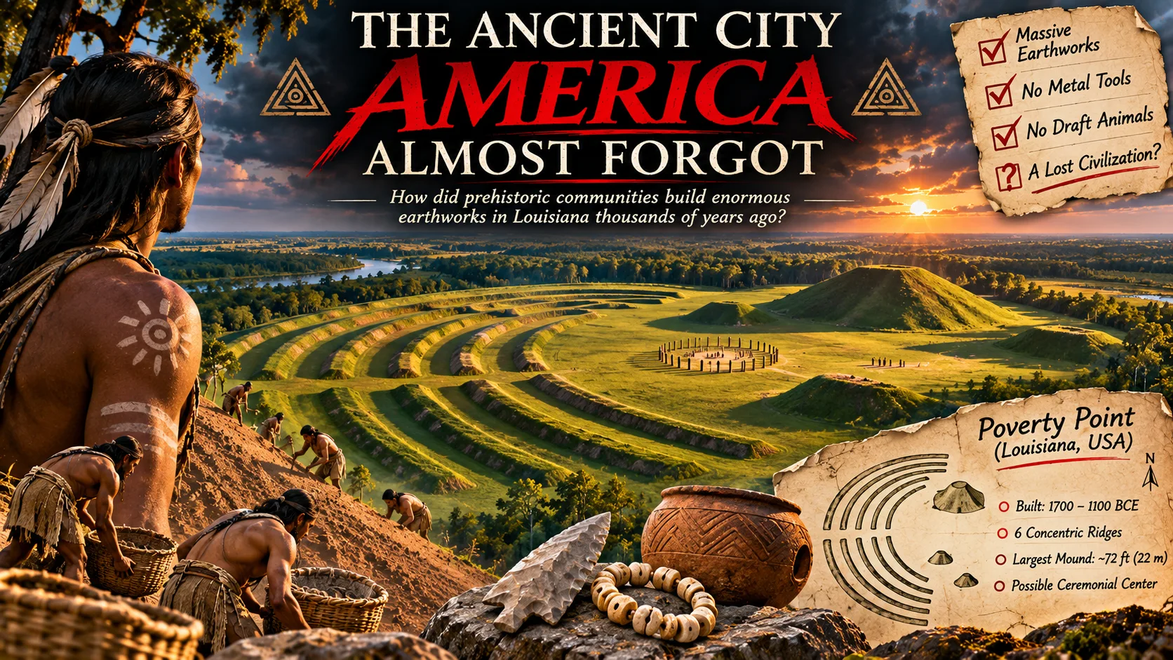
But from the air, something impossible to ignore emerged: six immense earthen arcs bending around a central open space, with giant mounds rising nearby.
Not natural hills. Not a modern construction project.
A landscape deliberately reshaped by human hands more than three thousand years ago.
Its true design only became clear to archaeologists in the twentieth century.
Who built this? And how had their achievement remained so easy to overlook?
The Shape Hidden in the Grass
We call it Poverty Point, after a nineteenth-century plantation. Its builders' name for it is lost.
Between roughly 1700 and 1100 BCE, Indigenous communities built this complex.
Six enormous, roughly C-shaped ridges surrounded a broad plaza. The outer arc stretched about 1.14 kilometres across. Great earthen mounds rose nearby, including Mound A, around 22 metres high.
Think of the work required to move that much earth.
Now remove the equipment you'd expect to see.
No excavators. No trucks. No wheeled carts or draft animals. No metal shovels.
Workers moved and shaped soil by hand, likely using baskets or bags.
But the biggest surprise wasn't how large the place was.
It was who made it.
The Builders Who Weren't Supposed to Build Monuments
Monumental construction was long associated with farmers, rulers, and states.
Poverty Point complicated that assumption.
Its builders were hunter-fisher-gatherers, living from rivers, forests, and wetlands.
Yet they could organize work on an enormous scale.
Imagine people carrying earth while others marked the shape of ridges too large to see from the ground.
That scene is an illustration; their actual work system remains unknown.
And that's the real mystery: How do you coordinate a monumental project when the social system behind it has left no written explanation?
The earth itself offers a clue.
A Mountain Built in a Season?
Researchers studying Mound A have argued that its massive volume of soil may have been assembled in no more than about ninety days.
If that estimate is right, its builders achieved an astonishing burst of coordinated labor.
At least one ridge segment also appears to have been built rapidly, its soil deliberately layered.
Speed does not prove a ruler commanded the work or that labor was forced.
Evidence of a clear ruling hierarchy has not been established.
Some people may have lived there year-round; others may have gathered seasonally.
The earthworks are proof of organization.
They are not a written record of who gave the instructions.
Then researchers uncovered something that expanded the mystery far beyond Louisiana.
Stones That Shouldn't Have Been There
Useful stone is scarce around Poverty Point.
Yet tools and ornaments contain stone sourced from distant parts of the Midwest and Southeast.
How did they get there?
Through exchange networks extending hundreds of kilometres, probably aided by rivers.
There were spear points, fishing tools, beads, and clay cooking objects too.
Imagine someone preparing clay cooking pieces while others build a mound.
One small object. One colossal landscape.
Both belong to the same remarkable human story.
Poverty Point wasn't an isolated puzzle abandoned in a swamp. It was connected to a much wider world.
But what was the great plaza for?
The Empty Space at the Center
In the central plaza, archaeologists found traces of large circles of wooden posts.
Did people gather for ceremonies, meetings, or seasonal events?
Archaeologists have hypotheses, but the precise purposes of the different features remain uncertain.
That uncertainty matters.
It's tempting to declare the site a lost capital ruled by forgotten kings, or a temple designed around a secret celestial code.
The evidence doesn't justify either certainty.
It had residential and ceremonial uses, but calling it a city remains interpretive.
One mound was added long after the main construction period.
The landscape preserves layers of human activity, not a single frozen moment.
The View That Changed the Story
The earthworks were reported in the nineteenth century, but their ridges were once mistaken for natural formations.
Aerial views in the 1950s revealed their geometric design.
Imagine that realization.
The great arcs had been there all along. People had walked on the landscape without seeing the full shape beneath their feet.
UNESCO listed Poverty Point as World Heritage in 2014, recognizing earthworks unmatched in North America for at least 2,000 years.
The Indigenous builders had left an extraordinary achievement hiding in plain sight.
The Question the Earth Still Asks
Stand at Poverty Point today and the monuments may look quiet.
Grassy ridges. Open sky. Earth rising gently beneath your shoes.
Every mound records human work; every imported stone records a distant connection.
We may never know what they called their monumental landscape.
But we know enough to reject the idea that prehistoric communities needed metal, wheels, or a king to create something monumental.
The mystery isn't how people so ancient could have been capable of such engineering.
It's why we were so ready to underestimate them.